Member-only story
What Makes a Map Good
The most useful maps distort what they depict and leave out tons of possible information
 From its earliest days, humankind has put thought into the world: cave art depicting animals, tallies on sticks and bones, and especially a wide variety of maps, suited to different purposes, from a small portable stone map found in Spain that was used for navigation by foot to the floating bamboo-and-shell “stick” maps that the Marshall Islanders used for navigating the open ocean. Different as they are, the best maps share core features. They aren’t always to scale. They mix perspectives. They depict as well as map. They omit masses of information. This isn’t just from ignorance or lack of technical sophistication—it’s by design. What’s included is exactly the information that the map users need, uncluttered by information they don’t need.
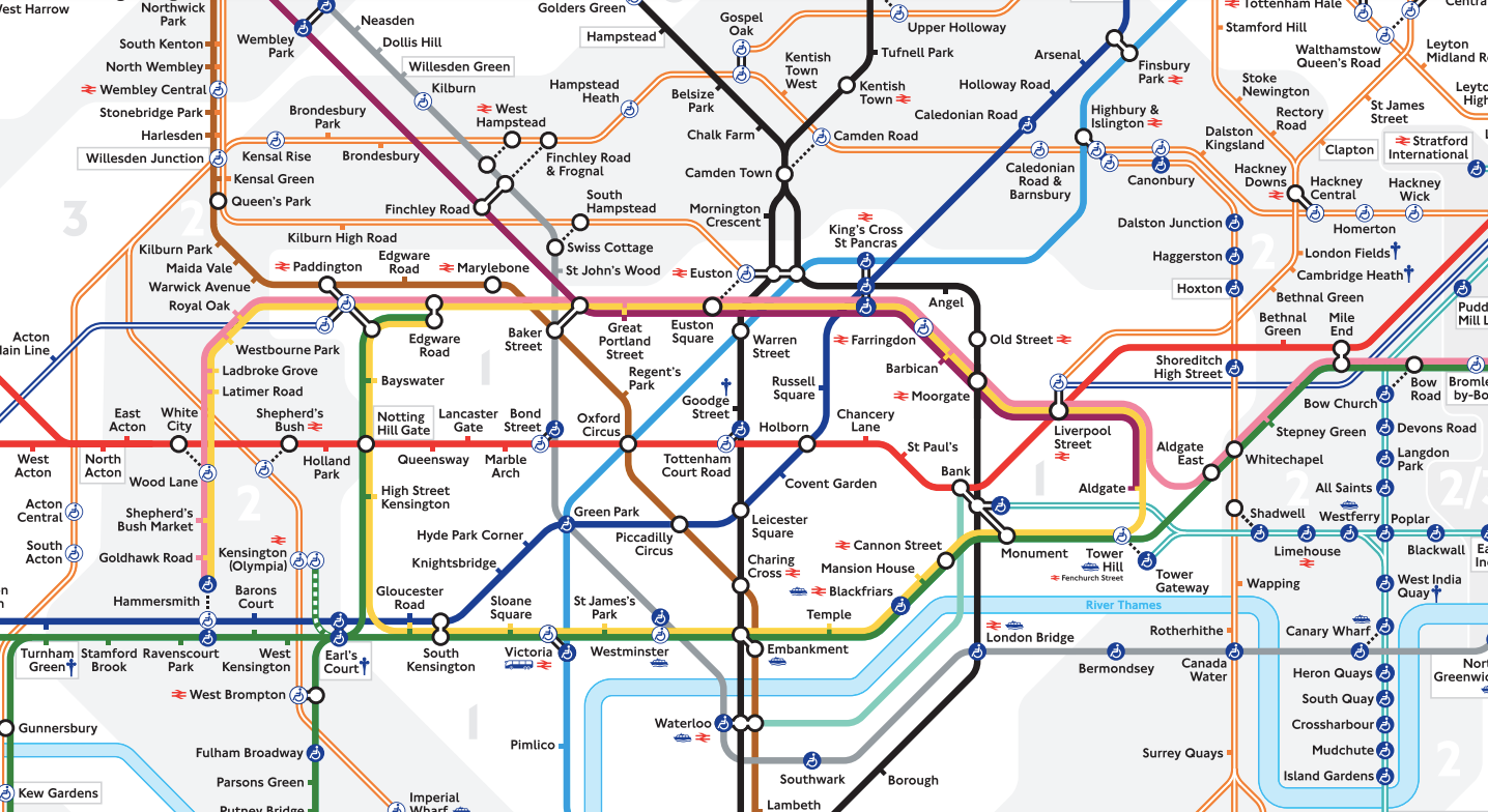
Take, for instance, the London Tube map. Harry Beck’s map of the London Underground entered the world in 1931 and has since been imitated by transportation systems all around the globe. It shows — but distorts — a simplified skeleton of the train lines, depicted as lines running vertically, horizontally, or diagonally, by no means an accurate reflection of their pathways.
The insight that inspired the map came from electronic circuit diagrams, a fascinating instance of…

